A Met Office yellow weather warning for ice states that ‘snow and hail showers could lead to icy surfaces, with possible travel disruption’.
30 March 2022
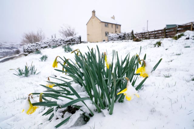
Snow, hail, ice and cold is set to replace the spring sunshine and warm temperatures of recent days across parts of England and Scotland.
A Met Office yellow weather warning for ice covering a large swathe of eastern Scotland, north-east England and Yorkshire until Thursday morning states that “snow and hail showers could lead to icy surfaces, with possible travel disruption”.
Overnight wintry showers could see ” fairly widespread icy patches, particularly on untreated surfaces”.
It also adds that “some accumulations of snow are also possible”, particularly across eastern Scotland and hillier areas of north-east England.
After a cold and icy start in places on #ThursdayMorning, it will be a day of sunshine and showers
Showers falling as a mixture of rain, sleet and hill snow across the country
Feeling much colder across all areas pic.twitter.com/haYRzoHr8s
— Met Office (@metoffice) March 30, 2022
With temperatures set to drop 10C lower than those registered last week, and well below average for this time of year, councils in Newcastle City, North Tyneside and Gateshead have all introduced their severe weather emergency protocols – which includes services to help people who are sleeping rough try to stay safe.
They are urging people to get in touch if they are worried about someone who is sleeping rough.
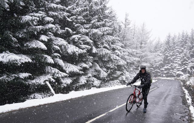
On Wednesday, Terry Smith, 57, of Coventry, who is undertaking the coast to coast route – which he started from Whitehaven in Cumbria, hit snow in Allenheads, in the Pennines to the north of Weardale in Northumberland.
Met Office meteorologist Aiden McGivern said: “The last few days have seen a significant trend. A trend away from sunshine and temperatures of 20C to Arctic air coming south across the UK behind a cold front which has brought, in some places, snowfall.
“As it crosses the south of the UK for the start of Thursday, it could even bring some slight snow coverings to south-eastern areas.”
This would be mainly over the hills and may touch on places such as the South Downs and the Chilterns, but it would not last long as the sun will soon clear it up.
Mr McGivern said: “There will be further wintry showers coming into the east and the north through Thursday on a biting north easterly wind which will be particularly strong on the coast of Kent.
“There is a potential for gales on exposed spots.”
There will be some sunny spells, but Mr McGivern described it as “a bright day if on the cold side with and temperatures that are well below average for this time of year” before the skies clear on Thursday evening.
The cold snap is expected to last until the weekend when slightly warmer weather will come in from the west, bringing unsettled conditions.
Until then, temperatures are expected to be half those reached last week, when many areas basked in glorious sunshine and highs of 20C.
And thermometers will fall below freezing overnight as the cold front pushes down from the north.
Commercial director at Green Flag, Mark Newberry, said: “Although many of us thought the colder weather was behind us, it’s unfortunately starting to feel like winter again.
“After the lovely sunshine of recent days, the temperature is set to drop even further towards the end of this week, with some parts of the UK expecting snow, sleet, and icy conditions.
“Green Flag is urging drivers to take extra care when setting off on their journeys.”